
New Brighton ZIP Code Coverage
The official material supports one core mailing code for New Brighton proper: 55112. City Hall, the library, and the New Brighton Post Office all use it. Ramsey County’s GIS layer also shows 55126 and other nearby postal polygons, but the county layer is mapping context rather than a USPS city-limit crosswalk. No official source reviewed ties a 55126 street in New Brighton proper to that code. Treat it as an address-level question, not as a second city code.
| ZIP | Areas Covered | Post Office | Notes |
|---|---|---|---|
| 55112 | Core New Brighton mailing geography, including documented city and library addresses | New Brighton Post Office, listed with a Saint Paul postal city | Only code verified as serving New Brighton proper |
| 55126 | Ramsey County ZIP-polygon layer and nearby north-suburban context | No New Brighton-serving post office confirmed in the reviewed material | Verify each address with USPS before calling it New Brighton |
| 55113 and other nearby codes | Neighboring Ramsey County map context | No New Brighton assignment verified | Do not label as New Brighton without an address-level result |
The table does not claim a complete postal map. It records what the reviewed city, county, and USPS sources establish. No official ZIP split, realignment year, PO-box-only New Brighton code, or unique-institution code was found. A ZIP code directory should show that uncertainty plainly rather than turn a broad polygon into a precise statement.
New Brighton 55112 Details
The USPS New Brighton Post Office listing identifies the post office at 525 Main Street, Saint Paul, MN 55112-9998, with phone 651-639-9306. The inspected retail hours were Monday through Friday 8:30 a.m. to 5 p.m. and Saturday 9:30 a.m. to 1 p.m. The same listing identifies a carrier annex at 200 5th Avenue NW, Saint Paul, MN 55112-3388. These are postal-service facts, not a decision about municipal boundaries.
The USPS location page is the source for the postal details shown here.
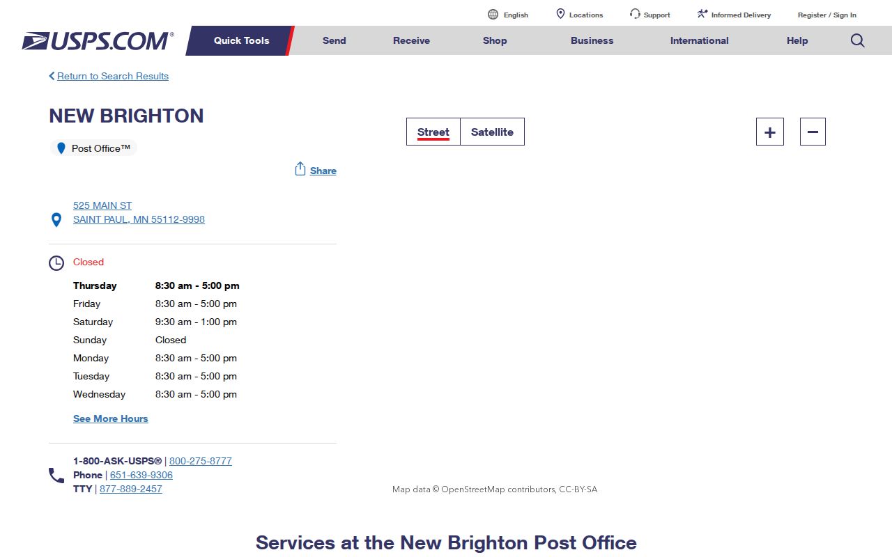
A Saint Paul postal city on this listing does not mean that a verified New Brighton address lies inside the City of Saint Paul. USPS explains that ZIPs support delivery and can change, while city limits, precincts, school districts, and parcel boundaries follow different systems.
Verify a New Brighton ZIP
Use USPS address lookup as the final delivery-format check for a specific address. Then compare that result with the City of New Brighton Address Atlas and Ramsey County parcel mapping. The city atlas is an orientation tool, not a boundary survey, and its July 2024 edition should be dated in any research notes. MapRamsey shows tax-parcel geometry and administrative layers, but the ZIP layer can differ from delivery logic at an edge.
The verified sequence is simple: retain the USPS-standardized address, postal city, ZIP+4 if returned, municipal city, county parcel identifier, and source date. If those fields disagree, record the disagreement and ask USPS, City planning, or Ramsey GIS for clarification. Do not quietly choose the result that seems most convenient.
Note: A postal label can normalize delivery mail without proving a city limit, parcel boundary, or ownership relationship.
New Brighton ZIP Search Fields
Minnesota’s MNVotes registration-status checker includes a ZIP route for an individual status check. It is not a searchable public roster. The form needs exact identifying information and an address selection after the geographic choice. Its result supplies status or next-step information, not proof of ownership or a way to create a list of households. Keep the full date of birth inside the official form and never copy it into research notes intended for publication.
| First name | Required text field; use the official spelling. |
|---|---|
| Last name | Required text field; the inspected form excludes Jr. and Sr. suffixes. |
| Month, day, year of birth | Required numeric fields in the official check; sensitive and not for publication. |
| ZIP route | A five-digit ZIP path or a county route can be selected. |
| City or township | Loads after the county choice and does not define a city-limit boundary. |
| House number and street | Used with the selected address, including directional street details and a conditional unit field. |
For a public voter-list request, Minn. Stat. §201.091 controls the allowed use, written purpose, requester identification, and restrictions. The statutory public list cannot be republished as a searchable web directory, sold, loaned, or redistributed.
New Brighton ZIP Searches
A ZIP can narrow a records question, but each source uses it differently. MNVotes uses ZIP as one address route for an individual status check. MapRamsey lets a researcher inspect a ZIP5 administrative polygon. Beacon expects a street address and city or another property identifier, so it should use the ZIP only as a normalization check. RecordEASE and court records do not offer a ZIP-first way to find people; their search paths rely on property or court identifiers.
- Confirm the full mailing address through USPS and save the postal city, ZIP, ZIP+4 when returned, and lookup date.
- Use Beacon’s address search to obtain the county parcel record, then preserve the PIN, situs address, and legal description as separate fields.
- Open MapRamsey, inspect the ZIP and parcel layers, and save the layer name, map date, and any edge mismatch.
- Use MNVotes only for the permitted individual registration-status check, with the full official form requirements.
- Move to a street-based record trail only after the address and parcel relationship are documented.
Once a ZIP search reaches one street, the New Brighton street directory gives the separate address and parcel workflow. It should not be replaced by a ZIP-wide assumption.
New Brighton Parcel ZIP Context
The Ramsey County Property Tax and Value Lookup directs property research to Beacon. Its documented search modes include address autocomplete, house number and street, city, full PIN, plat, block and lot, sales-date range, and property-class filters. The assessor card is a parcel and assessment lead, not a certified title opinion. A full PIN can be entered with or without punctuation.
MapRamsey adds parcel geometry, current and historic aerial or oblique imagery, classification, valuation, and administrative layers. The parcel REST layer exposes address-related fields and geometry, including ParcelID and street components. Compare the returned parcel with Beacon before moving to Recorder records. The parcel may remain stable when a mailing format changes, while a replat or split can create a new relationship.
New Brighton ZIP Boundaries
ZIP boundaries and New Brighton city limits do not line up by definition. USPS says ZIPs serve delivery needs. Ramsey’s ZIP layer is an administrative polygon. A precinct, school district, neighborhood, and city parcel can each have another edge. The documented 55126 polygon is a clear local caution: it appears in county mapping, yet the research did not verify a New Brighton-proper street served by it. An exact address must be checked before it is described as a New Brighton address.
- ZIP code and ZIP+4
- The five-digit delivery area and its added four digits, which can refine mail sorting for a particular address.
- PO-box ZIP
- A delivery code used for post-office boxes rather than proof that it covers nearby street addresses.
- Unique ZIP
- A code assigned to one institution or organization. None was verified for New Brighton in the reviewed material.
- Carrier route
- A delivery route within postal operations, not a municipal or property boundary.
New Brighton’s city history adds another layer. A modern address may have a village or Mounds View Township predecessor, while an Exchange or Butchers Spur reference may identify a historic district. Postal city, municipality, school district, precinct, and historical place name should remain separate fields.
New Brighton ZIP Evidence Card
An edge address deserves a short evidence card rather than a casual label. The card keeps delivery, parcel, and municipal facts in view at the same time. It is especially useful when USPS returns a Saint Paul postal city or when a county map shows a nearby ZIP polygon. The research record should identify the source and date for every field, because portal displays and delivery data can change.
| USPS result | Standardized address, postal city, ZIP, ZIP+4 when returned, and lookup date. |
|---|---|
| Municipal result | New Brighton address-atlas or city-GIS reference, including the map edition or layer date. |
| County parcel result | PIN or ParcelID, situs address, legal description, and MapRamsey layer or query date. |
| Unresolved field | A plainly labeled gap, followed by the office or service that can verify it. |
That approach preserves a real mismatch instead of turning it into a false conclusion. It also distinguishes a postal format from a property record.
New Brighton Postal History
Postal research can benefit from local history without turning old place names into present mailing claims. New Brighton was surveyed and platted in 1887, incorporated as a village in 1891, and became a city in 1974. Older records may use Mounds View Township or rail and industrial terms such as New Brighton Exchange, Butchers Spur, and Northwest Quadrant. Those terms can improve a newspaper, map, directory, or deed search when a modern postal query produces no result.
They do not prove a ZIP relationship. Match the historic term to a dated document, street, parcel, or institution. The city’s History of New Brighton and Exchange history provide the documented vocabulary for this local geography.
New Brighton ZIP Record Fallbacks
When USPS, Beacon, and MapRamsey do not reconcile an address, a targeted request can ask for a defined public record without asking the city to create a new dataset. New Brighton’s Data Request form asks for the requester’s contact information, a description of the data, and the desired access method. Describe the address, date range, city or ZIP question, and whether inspection or copies are wanted. Inspection is free under the city policy; copy charges may be estimated, and a request estimated at $50 or more requires prepayment.
The Minnesota Government Data Practices Act, Minn. Stat. ch. 13, presumes government data public unless classified otherwise, but it does not require a custodian to answer an undefined research question. City requests may be sent by mail, email, fax, or in person. For a street or parcel question, keep the USPS result, PIN, and map evidence together so the custodian can identify the record sought.
Note: A narrowly described address request is more useful than a ZIP-wide request for private customer or household information.